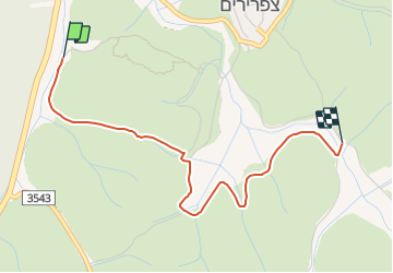
![](/images/other/stat-length.png)
![Randonnée A pied מועצה אזורית מטה יהודה - חורבת מדרס - מצפה משואה - Photo](https://media.geolcdn.com/t/1900/400/23e20ec2-f8ab-4812-845e-1d2e22127cad.jpeg&format=pjpeg&maxdim=2)
חורבת מדרס - מצפה משואה
SityTrail - itinéraires balisés pédestres
Tous les sentiers balisés d’Europe GUIDE+
![Longueur](/images/other/stat-length.png)
![Altitude max](https://static1.geolcdn.com/siteimages/upload/files/1508320355ic_sort_altitude_max_24dp.png)
![Dénivelé positif](https://static1.geolcdn.com/siteimages/upload/files/1508320355ic_sort_den_pos_24dp.png)
![Km-Effort](/images/other/stat-length.png)
![Altitude min](https://static1.geolcdn.com/siteimages/upload/files/1508320355ic_sort_altitude_min_24dp.png)
![Dénivelé négatif](https://static1.geolcdn.com/siteimages/upload/files/1508320355ic_sort_den_neg_24dp.png)
![Boucle](https://static1.geolcdn.com/siteimages/upload/files/16400158638029165_repeat_loop_refresh_sync_direction_icon.png)
![A pied](https://static1.geolcdn.com/sitytour/trail-icons/100.png)
1h08
Difficulté : Facile
![Scannez ce code QR pour ouvrir la randonnée dans l'application SityTrail](https://capi.geolives.com/qq0zvz2zws4bq2lad0pu/sitytour/trails/3141822/qr.png?size=200)
Application GPS de randonnée GRATUITE
À propos
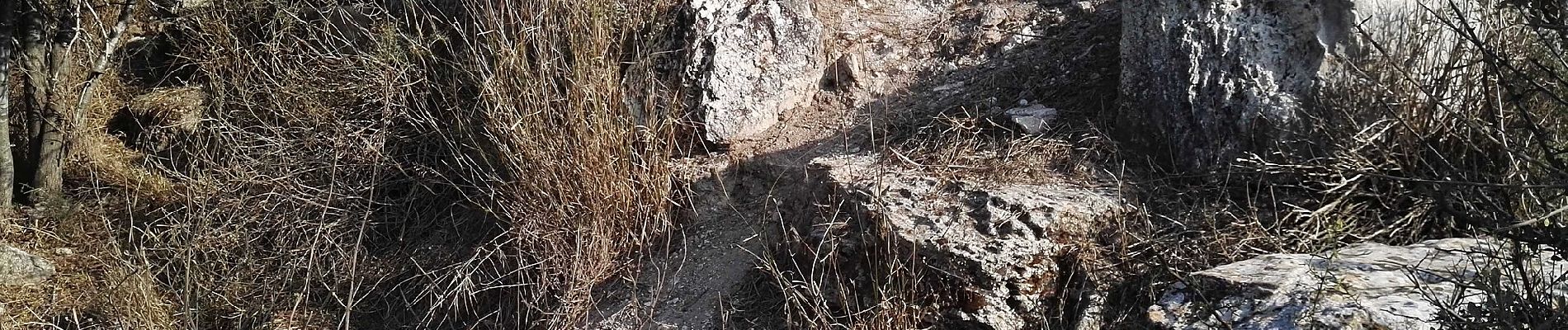
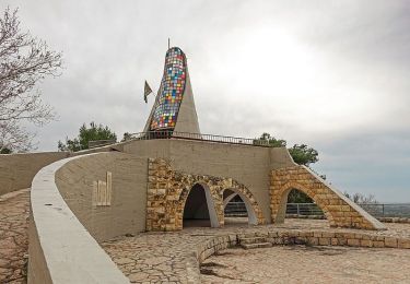
Randonnée A pied de 3,9 km à découvrir à District de Jérusalem, Inconnu, מועצה אזורית מטה יהודה. Cette randonnée est proposée par SityTrail - itinéraires balisés pédestres.
Description
Randonnée créée par itc.
הודעה מקק"ל - השביל האדום 9446 ממצפה משואה לחירבית מידרס סגור זמנית לטיול ,עקב בעיות בטיחות בחציית כביש 38 (שדה ראייה מוגבל). אנו נערכים לאיתור מסלול חלופי שישרת את המטיילים הרבים הפוקדים את האזור.
Localisation
Commentaires
Randonnées à proximité
![Randonnée A pied מועצה אזורית מטה יהודה - IL-9444 - Photo](https://media.geolcdn.com/t/375/260/54914d59-1447-43c2-ba25-b7261ab98cee.jpeg&format=jpg&maxdim=2)
![A pied A pied](https://static1.geolcdn.com/sitytour/trail-icons/100.png)
A pied
![](/images/other/stat-length.png)
![](https://static1.geolcdn.com/siteimages/upload/files/16400158638029165_repeat_loop_refresh_sync_direction_icon.png)
![Randonnée A pied מועצה אזורית יואב - IL-12132 - Photo](https://media.geolcdn.com/t/375/260/0477f215-5ba0-43b9-877a-fd5ba6304cdb.jpeg&format=jpg&maxdim=2)
![A pied A pied](https://static1.geolcdn.com/sitytour/trail-icons/100.png)
A pied
![](/images/other/stat-length.png)
![](https://static1.geolcdn.com/siteimages/upload/files/16400158638029165_repeat_loop_refresh_sync_direction_icon.png)
![Randonnée A pied מועצה אזורית מטה יהודה - מצפה משואה - לוזית - Photo](https://media.geolcdn.com/t/375/260/ext.jpg?maxdim=2&url=https%3A%2F%2Fstatic1.geolcdn.com%2Fsiteimages%2Fupload%2Ffiles%2F1545311037marcheuse_200dpi.jpg)
![A pied A pied](https://static1.geolcdn.com/sitytour/trail-icons/100.png)
A pied
![](/images/other/stat-length.png)
![](https://static1.geolcdn.com/siteimages/upload/files/16400158638029165_repeat_loop_refresh_sync_direction_icon.png)